

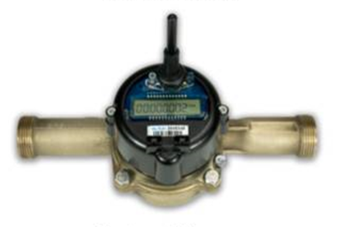
Metering your water use
I want to...
Metering is required for certain uses
Not all water right holders are required to report water use, but they are required to keep the most current five years of metering records on site. Below are some examples of water uses that requires metering:
- All new surface water uses
- All existing surface water uses greater than one cubic foot of water per second
- All new water right permits issued in the 16 fish-critical watersheds
- Some water uses in water-short areas
- Some mitigated water uses
- Some uses of water from reserves
Special circumstances
Yakima River Basin — Yakima County Superior Court requires holders of confirmed water rights to meter their water use. Yakima County Superior Court issued a metering order (pdf) for all confirmed surface water right holders in Benton, Kittitas, and Yakima counties, except tribal lands. Close to 3,000 water rights have been confirmed as part of the Yakima River Basin adjudication.
- Large water diversions of one cubic foot per second (cfs) or greater are required to meter and report their diversions to us.
- Smaller diversions must meter and retain the data for the most recent five years, and make it available to us on request.
- Yakima River Basin map
Note: In 1994, the court ordered Yakima, Tieton, and Naches rivers' mainstem water users who divert one cubic foot per second or more to install and maintain measuring devices, to report their use to the U.S. Bureau of Reclamation, and to notify the Bureau in advance of any adjustments to their diversion rates. Those requirements remain in place and are not changed by this order.
Office of Columbia River — The Legislature directs us to collect and publish metering data from water users who divert or withdraw water from the Columbia River corridor. The Columbia River corridor consists of the Columbia River from Bonneville Dam to the Canadian border, the Snake River up to Lower Monumental Dam, and any use within a mile of each bank of these river reaches.
-
More information about Columbia River water use compliance
Reporting your metering data online
Most water metering reports are due every year by January 31. Use the links below to access your reporting account or to request a new account:
For additional help:
- How to properly collect and document water level data from your well
- A quick reference guide to reporting your water use online
Meter forms and information
- Measuring device information (Form 1) — provides us with information about your measuring device and water rights associated with the device. We require this form if a water right has been provisioned or ordered to meter.
- Water use data collection reporting form — to collect source metering data for reporting
- Metering technical information — includes information about pressurized systems, open channel systems, and meter vendors and installers.
Laws & rules
Revised Code of Washington (RCW):
- RCW 90.03.360 — Controlling works and measuring devices
- RCW 90.44.050 — Permit to withdraw
- RCW 90.44.250 — Investigations – reports of appropriators
- RCW 90.44.450 — Metering or measuring groundwater withdrawals
- RCW 43.21A.064(8) — Powers and duties – water resources
- RCW 43.27A(090)(11) — Powers and duties of department
Washington Administrative Code (WAC):
- Chapter 173-173 WAC — Requirements for measuring and reporting water use
Related links
Contact information
Northwest Region
Island, King, Kitsap, San Juan, Skagit, Snohomish, and Whatcom counties
Jess Yates
Environmental Specialist
jess.yates@ecy.wa.gov
206-594-0208
Southwest Region
Clallam, Clark, Cowlitz, Grays Harbor, Jefferson, Mason, Lewis, Pacific, Pierce, Skamania, Thurston, and Wahkiakum counties
Arlene Harris
Environmental specialist
arlene.harris@ecy.wa.gov
425-516-4968
Central Region
Benton, Chelan, Douglas, Kittitas, Klickitat, Okanogan, and Yakima counties
Kailey Sawyer
Metering Coordinator
kailey.jensen@ecy.wa.gov
509-731-6332
Eastern Region
Adams, Asotin, Columbia, Ferry, Franklin, Garfield, Grant, Lincoln, Pend Oreille, Spokane, Stevens, Walla Walla, and Whitman counties
Tracy Band
Hydrogeologist
tracy.band@ecy.wa.gov
509-385-5846
Office of Columbia River in Union Gap
Stephen Radke
Environmental Specialist
Stephen.Radke@ecy.wa.gov
509-208-5020