Watershed characterization a set of water and habitat assessments that compare areas within a watershed for restoration and protection value. It is a coarse-scale tool that supports decisions regarding:
- Where on the landscape efforts should be focused first
- What types of actions are most appropriate for that place
As a decision support tool, the characterization results can be used to:
- Understand the role an area plays in supporting watershed health
- Understand why certain actions may be beneficial in sustaining the watershed
- Guide the development of a range of management plans, including:
- Land use plans
- Stormwater retrofit plans
- Open space and conservation plans
- Floodplain restoration plans
- Salmon and habitat recovery plans
- Help direct limited funds to areas providing greater restoration benefits.
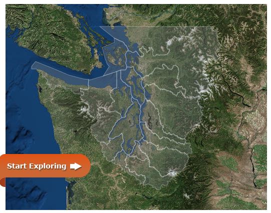
Here you can find water flow and water quality assessments for each of the 19 Puget Sound Water Resource Inventory Areas (WRIAs). The geographic information system (GIS) data is available for download on our GIS data page.
Files contained in the geodatabase include:
- Final results for two assessments: water flow and water quality
- Source data used in the analyses
- All intermediate data layers
Upon request, we can also run assessments for different combinations and sizes of watersheds to address specific needs of a local government or non-governmental organization.
Water assessment information for planners
For a general introduction to the water assessments, see our guide for local planners: Puget Sound Watershed Characterization: Introduction to the Water Flow Assessment for Puget Sound, July 2010.
This document provides examples of how planners can use the information for planning decisions and how it is currently being applied.It contains a general description of:
- The water flow assessment
- How the information can be used
- Intended users
- Planning processes it can support
For a detailed description of the characterization, see the final technical document and addendum: Puget Sound Characterization Volume 1: The Water Resource Assessments (Water Flow and Water Quality).
This document describes methods, models, and analyses for the water flow and water quality assessments of Puget Sound WRIAs as well as methods and guidance for applying the model results.
An addendum to Volume 1 was added in July, 2019. With this addendum Ecology updated the Water Flow models to reflect more recent spatial data, changes to assessment unit boundaries, and testing of model stability which lead to a refined index aggregation formula for the Overall Water Flow assessment. The addendum should not be used as a stand-alone document, but in conjunction with Volume 1.
The complete habitat assessment for the Puget Sound basin includes models for:
- A landscape assessment for terrestrial wildlife
- A freshwater fish and wildlife assessment
- An assessment for marine and near-shore fish and wildlife
The final document describing habitat assessment methods, models, analyses, and guidance for applying the results to Puget Sound watersheds was published in December 2013.
See the final technical document - Puget Sound Watershed Characterization Volume 2: A Coarse-scale Assessment of the Relative Value of Small Drainage Areas and Marine Shorelines for the Conservation of Fish and Wildlife Habitats in Puget Sound Basin.
The data for the habitat assessment are available for download on our GIS data page.
The Puget Sound Characterization program has tested the potential application of a mid-scale tool known as the Hydrologic Condition Index for use throughout Puget Sound watersheds. The HCI index is based on detailed hydrologic modeling that generates coefficients predicting the “flashiness” of stream flows that a given combination of land cover and surficial geology would likely produce in a watershed.
Testing of the HCI index for “alternative futures” applications indicate potential as a useful tool in assessing implications of development patterns on the hydrologic health of a watershed. Use of this tool can assist local governments locate future development in a manner that minimizes impacts to watershed hydrological condition.
See Puget Sound Watershed Characterization, Volume 4: Mid-Scale Assessment of Hydrologic Condition for more information, including:
- Preferred methods for calculation of the index based upon initial testing and validation using stream gage data in a series of watersheds in central Puget Sound.
- Recommendations for further development of the mid-scale tool so that it can be applied regionally are provided.
Also see the Story Map: New Mid-Scale Assessment Tool for Puget Sound (2019).
With ongoing funding from EPA's National Estuary Program, Ecology provides technical assistance in the form of:
- Guidance interpreting downloadable assessment results.
- Working with local governments and resource managers to tailor and apply a water assessment in a multi-scale framework for specific watersheds to inform such activities as:
- Comprehensive and shoreline plan updates
- Subarea plans
- Stormwater planning
- In-lieu fee mitigation programs
- Prioritization of areas for acquisition and restoration.
- Trainings, presentations, and maintaining a website and web map which provide access to the geospatial data and example applications for planning projects.